7 August 2024
Tactile diagrams say so much that words cannot say
By Dave Horwood
Since I lost my sight at the age of three, tactile diagrams, charts, images and maps have been useful to me in so many ways. Read on to find out how I use tactile diagrams in my daily life and how A2i can help with your tactile projects.
Why are tactile diagrams important?
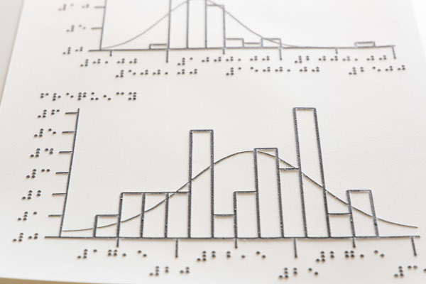
In my early life, I used tactile charts and diagrams in Maths, Science and Computing lessons at school and college. This interesting article from Bristol’s Sensory Support Service shares some interesting tips on how to design tactile diagrams in an education setting.
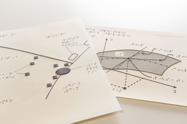
I’ve also used tactile maps to understand the layout of a public building like a train station, familiarise myself with the layout of a town centre and to help with orientation around my workplace.
When I started in my role at A2i, my manager Susie produced a tactile floorplan of the office which shows where everyone’s desks are and the location of the kitchen and the stairs. Susie also made a tactile map that covers the local area to the office, and I use tactile graphs in team meetings which allow me to fully take part in the discussion.
Tactile images have also allowed me to appreciate some art, and learn what well-known buildings and famous landmarks look like. Living Paintings Trust have a wide selection of tactile images, as part of information packs and story books for adults and children.
Using tactile maps for navigation
Providing accessible tactile information like Braille maps can improve a blind person’s confidence and independence so we feel fully included and less reliant on others. For example, exploring a museum using a tactile map and audio guide or walking to a friend’s house with the help of a tactile map. Whilst I do use accessible GPS apps during a walk, the tactile map increases my understanding of the space around me and how local places connect, to a much greater degree. Most notably the road layout and the angle that the roads meet at a junction, as well as the size and shape of the park that I would be walking through on route. Accessible GPS apps on smartphones have come a long way, but they still cannot describe the road layout in much detail, the terrain, or the size of buildings or open spaces. GPS only has an accuracy of between 5 and 10 metres so we have to use other techniques for the last few steps of our journey to find the door/entrance.
Where can you currently find tactile diagrams in public places?
While tactile diagrams are sometimes available in public places, they are often not well publicised, or it is common to find that one building has a map available but another building run by the same organisation does not. There is also the issue of the map not being publicised in an accessible format such as being mentioned in printed literature only, or often no mention of the tactile diagrams at all. It would be great if there was a directory listing all venues that provide tactile diagrams in the UK, or internationally. This would encourage me as well as other visually impaired people to travel more and visit new places.

How to make your diagrams tactile
At A2i we can translate your diagrams, charts, maps and images into tactile format. We can add accompanying Braille labels and collate tactile diagrams within your Braille documents. Visit the tactile page on our website to find out more.
You can send us an email: info@a2i.co.uk
fill out our online form
or call our telephone: 01179 44 00 44
In case you’ve missed us you can find our social media here:
Twitter: @A2iTranscribes
LinkedIn: a2i-transcription-services
Instagram: a2itranscription
YouTube: @a2itranscription